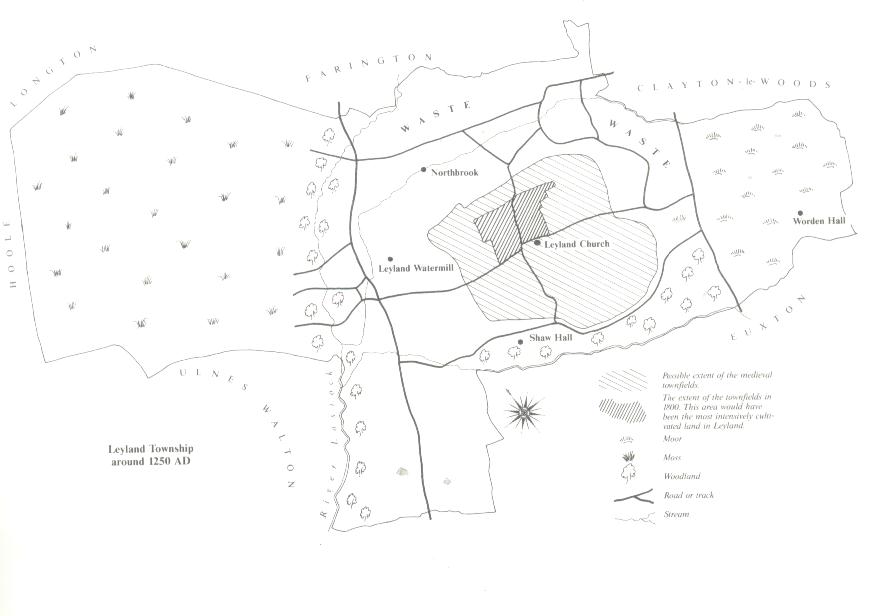
Historical Maps 1250-1769 Leyland 1250
Mostly fields at this point. Notice that the Parish Church is firmly established in it's elevated position. It can also be noted how paths of the rivers have not deviated from this time.
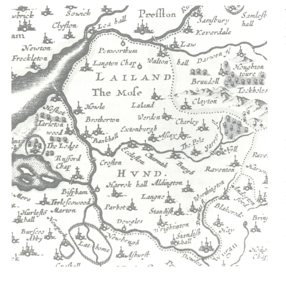
Leyland 1610
Leyland was an important township at this time having given it's name to the Hundred. Note the different spellings.
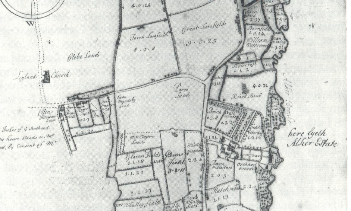
Leyland 1725
The dividing of the fields to the South side of the village. Alker Brook runs right along the Southern Border on the right of this map. Today it is known as Shaw Brook. Worden Park is on the right of the map (before it was a park)
Leyland 1725
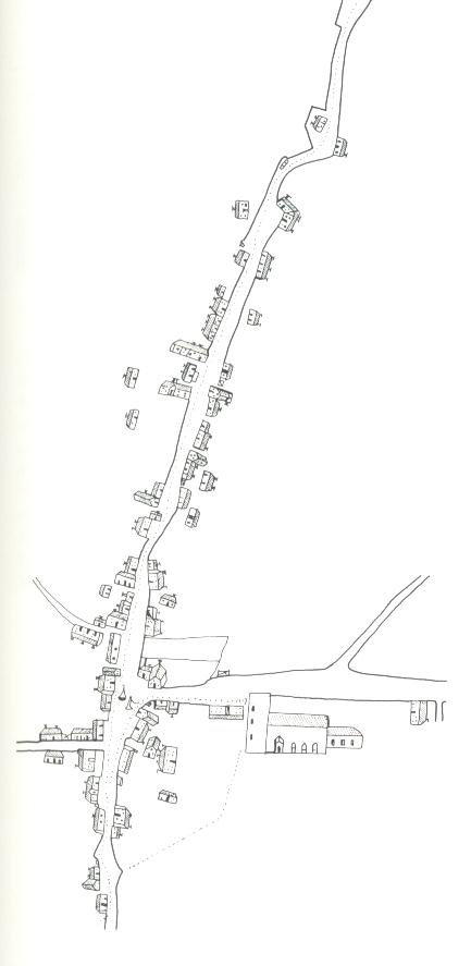
The village in 1725 shows the appearance of the old Grammar School at the bottom right of the picture next to the Parish Church. This picture also shows the Village Cross and the hand pump at the junction of Towngate and Church Road. The buildings that house the Roebuck and Bay Horse Inns are established too at this time. These are at the lowest junction on this map.