|
Historical Maps 1771-1840
|
|
|
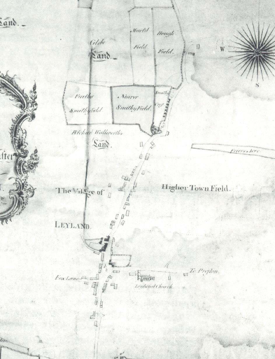
Leyland 1771
This map shows the first appearance of the Eagle and Child public house to the right of the Parish Church beyond the Old Grammar School.
Notice Hough Field near the top of the map. This is opposite the junction of what is today, Hough Lane.
The number of dwellings is still very scarce in the area.
The main road running North to South is Towngate. |
|
|
|
|
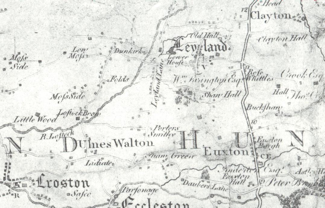
Leyland 1786
This map shows Leyland in relation to the surrounding districts. The Dunkirk can be seen towards the West of the town on the banks of the River Lostock.
This building is still with us today and serves the local community as a public house.
It is amazing how many of these roads are still with us today. See how many you can find. |
|
|
|
|
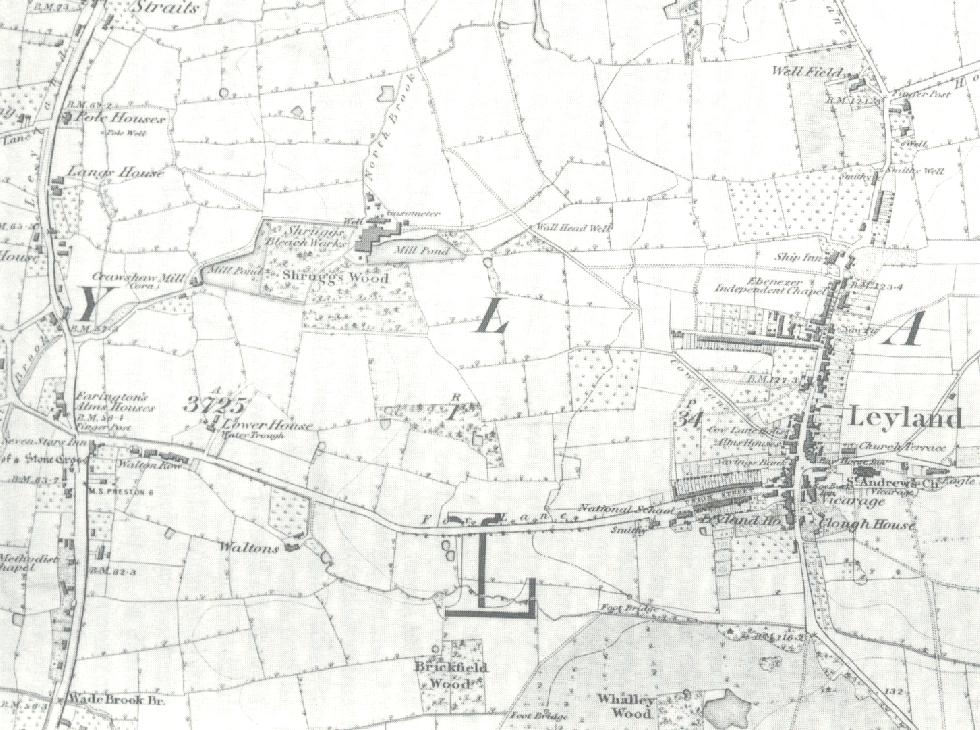
Leyland West 1840
This map shows the development to the West of the town. note the Alms Houses at Seven Stars. They were late moved up Fox Lane. Many of the buildings on this map still survive today. The main industry apart from weaving was the bleach works. These were to be supeceded by the cotton mills. The development around the parish Church continues . |
|
|
|
|
|
|
|
|
|
|
|
|
|
|
|
|
|
|
|
|
|